
Septic Tank Installation: A Complete Step-by-Step Guide
Whether you’re building on a rural lot or replacing a failing system, septic tank installation is one of the most regulated, and most consequential projects a homeowner can take on.


Every year, thousands of property owners face costly delays or outright rejections because their subdivision plan requirements weren’t met. From drainage miscalculations to missing zoning data, one overlooked detail can set your entire project back months.
It’s because a subdivision plan isn’t just a drawing – it’s a legal and technical roadmap that must comply with strict municipal regulations.
Here’s exactly what’s required to prepare a compliant, approval-ready plan that passes review the first time.

Requirements for a subdivision plan (sometimes called a subdivision site plan in certain jurisdictions) vary by jurisdiction but typically include: survey, zoning, drainage, utilities, and environmental documentation.
Even though every city or county has its own standards, the goal is the same: ensure each parcel is legal, buildable, and fully serviced.
Municipal staff review plan requirements, engineers and planners design and evaluate layouts, and surveyors delineate lot boundaries. Once the plan satisfies zoning, drainage, and infrastructure regulations, the local authority approves the final plat for recording.

A well-prepared plan includes technical, environmental, and legal documentation.
In the table below there are the key components every applicant should expect to provide for subdivision plan.
| Component | What It Must Show / Include | |
| 1. | Boundary & Survey Data | A licensed surveyor maps the property boundary, existing features, and easements with full geographic accuracy. |
| 2. | Zoning & Land-Use Compliance | Each lot must meet zoning density, frontage, and setback requirements to remain buildable. |
| 3. | Lot & Road Layout | The plan illustrates the proposed road network, access points, and intersections for safe traffic flow. |
| 4. | Drainage & Grading Plan | Engineers design drainage systems and grade elevations to prevent flooding and ensure proper water flow. |
| 5. | Infrastructure & Utilities | The layout identifies utilities like water, sewer, and stormwater systems, plus proposed infrastructure connections |
| 6. | Environmental & Legal Documentation | Environmental assessments, ownership verification, and permit applications prove legal and ecological compliance. |
| 7. | Final Plat Submission | The developer submits the engineered plat for municipal review and official recording after all approvals. |
Table 1: Subdivision plan core components
Once all these elements are organized into a cohesive drawing set, the next step is refining the design for submission – beginning with the preliminary and final plan stages.

Subdivision design always happens in two stages – preliminary and final.
Moreover, the preliminary version identifies geographic and zoning feasibility, while the final plan includes all documentation needed to obtain permits and record the plat (if you’re preparing the layout or early drawings for your subdivision, check out our detailed guide on Subdivision Plan Design).
With both versions prepared, your plan moves into the formal approval process, where local authorities examine every detail for accuracy and compliance.

Before any subdivision can move forward, local authorities review, inspect, and evaluate each submitted plan to ensure full compliance.
What reviewers look for in subdivision plan:
In brief, the approval process typically follows this flow:
Developer submits subdivision plan → Municipality reviews plan requirements → Local authority approves the final plat once all conditions are satisfied.
Additionally, revisions may be required if documentation is incomplete or if technical details fail to meet municipal standards. For a step-by-step guide to the process, see our article Land subdivision.

Once approved, a subdivision plan becomes an enforceable legal record that dictates how development proceeds.
After approval of subdivision plan:
An approved plan is both a permit foundation and a compliance guarantee – essential for safe, lawful land development.
Every jurisdiction publishes its own list of requirements for subdivision plan approval.
A general subdivision plan requirements checklist includes:
After your plan is approved and recorded, ongoing coordination between professionals ensures the project remains compliant through construction and final inspection.

Subdivision planning requires a combination of engineering precision, legal accuracy, and regulatory understanding. Errors can lead to project shutdowns, rejected permits, or even lawsuits.
Working with experienced professionals ensures your plan is compliant, technically sound, and ready for municipal review without costly rework.

At GetASitePlan, we prepare accurate subdivision designs that follow the same layout and zoning standards required in official subdivision plans.
Our drawings include proposed lot divisions, roads, drainage, and infrastructure layouts – perfect for visualizing your project or submitting preliminary concepts to local authorities.
Get a detailed, regulation-ready design that helps you plan ahead, consult with professionals, and move smoothly toward subdivision approval.


Creating a subdivision plan that meets all technical and legal requirements is more than just a paperwork exercise – it’s the foundation for a successful development. When each detail is accurate, approvals come faster, and construction can start without setbacks.
With GetASitePlan, you get subdivision designs that align with municipal standards, minimize revision risks, and streamline your path to approval. Our professionally prepared layouts help property owners move from concept to construction with confidence and compliance.

Whether you’re building on a rural lot or replacing a failing system, septic tank installation is one of the most regulated, and most consequential projects a homeowner can take on.
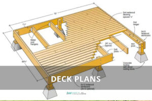
Ever tried explaining your dream deck without a drawing? Suddenly everyone’s imagining a different patio. That’s where a deck plan saves the day – the visual roadmap that turns “I

A landscape rendering gives you a 3D preview of your garden or yard – a chance to see every angle before any work begins. And it has gone digital. What