Room Addition Cost [2026 Data]
Adding a room to your house costs approximately $48,000 on average in 2026, with many homeowners spending between $20,900 and $72,600. Larger additions, bathrooms, and primary suites can cost considerably




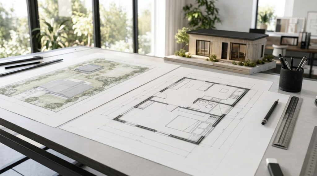

Planning a home addition, building a garage, or installing a swimming pool usually involves more than deciding where the new structure should go. You also need to show how the project fits within your property boundaries and complies with local building requirements.
A site plan is a scaled, overhead drawing of a property that shows existing structures, property lines, access points, and proposed improvements. It provides a clear picture of how buildings and other features are positioned on a piece of land.
Site plans are commonly used for building permits, zoning reviews, construction planning, and homeowners association (HOA) approvals. Their level of detail depends on the project, but the purpose remains the same: to document the property’s layout and help reviewers evaluate proposed changes.
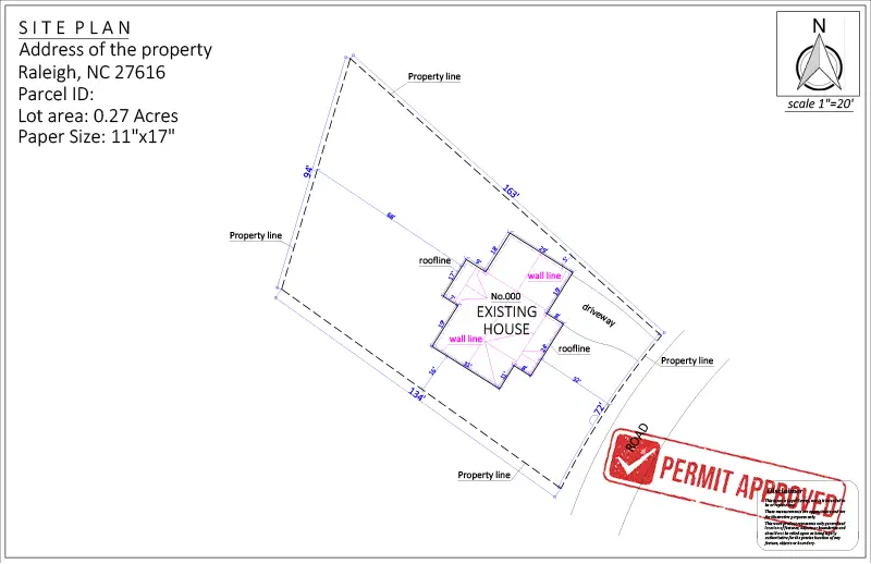
A site plan, also called a site layout plan, represents a property as viewed directly from above. Unlike a photograph or an ordinary map, it uses a consistent scale and measurements to show the positions and relationships of different features.
For example, a residential site plan might show a house, detached garage, driveway, fence, property boundaries, and the location of a proposed deck. A commercial site plan could also include parking areas, access roads, drainage systems, utilities, and landscaping.
The drawing helps property owners, contractors, architects, and local authorities understand how the land is currently used and what will change during construction.
As the City of Minneapolis explains, construction site plans identify property lines, existing structures, and the location of proposed improvements.
A complete site plan contains enough information to identify the property, locate existing features, and explain the proposed work. The exact requirements depend on the local building department and the type of construction.
The following elements are commonly included.

Some projects require additional information. For example, commercial developments can require fire access routes, parking calculations, stormwater systems, and accessible pathways.
The City of Vancouver’s residential site plan checklist provides a useful example of the information local authorities request, including easements, setbacks, utilities, and property dimensions.
For a detailed explanation of drawing conventions, see our guide on how to read a site plan.
The main purpose of a site plan is to show how a property is organized and whether proposed development fits within the available space and applicable regulations.
Building departments use site plans to evaluate zoning requirements, setbacks, building placement, access, and other development restrictions.
Contractors use them to understand where structures and improvements belong. Property owners use them to plan projects and identify potential conflicts before construction begins.
A site plan can reveal problems early. For example, a proposed garage might overlap a utility easement, or a home addition might extend into a required setback.
Identifying these problems during planning is generally easier and less expensive than correcting them after construction starts.
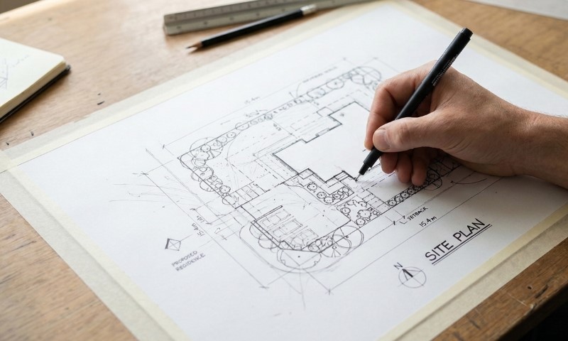
A site plan is commonly required when applying for permits involving new construction or changes to the exterior layout of a property.
Typical projects include new houses, home additions, detached garages, sheds, decks, swimming pools, driveways, fences, and accessory dwelling units (ADUs).
Commercial construction, land development, and subdivision projects generally involve more detailed documentation.
Site plans can also support HOA approval requests, even when the project does not require a building permit.
However, requirements differ between municipalities. A small shed might be exempt from a building permit in one jurisdiction but still be subject to zoning restrictions.
Before ordering a drawing, check which documents your local authority requires. Our guide to site plans for permits explains their role in the application process.
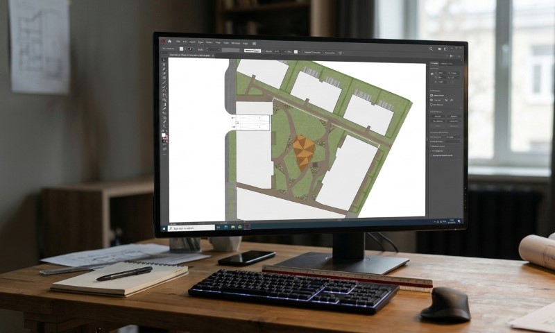
The easiest way to understand a site plan is to look at how it applies to actual construction projects.
A homeowner wants to build a detached garage behind an existing house.
The site plan shows the property boundaries, house, driveway, proposed garage footprint, and distances from the garage to nearby property lines.
It may also identify easements, utilities, and the proposed driveway connection.
The building department can use the drawing to review placement, setbacks, and site access before issuing the necessary approvals.
For a backyard swimming pool, the plan identifies the pool’s proposed location, dimensions, surrounding deck, and nearby structures.
Depending on local regulations, it may also show pool equipment, fencing, drainage, utilities, and required separation distances.
An accurate layout helps identify whether the pool fits within the available backyard space without conflicting with setbacks or easements.
A commercial site plan for a new retail building generally contains more information than a basic residential drawing.
Along with the building footprint, it can show parking spaces, vehicle entrances, pedestrian walkways, loading zones, landscaping, drainage facilities, and utility connections.
Larger developments may require separate engineering and infrastructure drawings.
You can explore additional site plan examples for homeowners, including decks, ADUs, fences, driveways, and grading projects.
Site plans can be presented as two-dimensional drawings or three-dimensional visualizations.
A 2D site plan shows the property from directly above. It uses lines, symbols, labels, and measurements to represent buildings, boundaries, and outdoor features.
2D plans are the standard format for most site plan submissions because they communicate locations, distances, and dimensions clearly.
A 3D site plan uses perspective, height, colors, and textures to illustrate how a property could look after development.
These visualizations help property owners understand the appearance of buildings, landscaping, and other improvements.
A 3D view is useful for design presentations, but it generally supplements rather than replaces the scaled 2D drawings required for permit review.
You can learn more about available 3D rendering services.
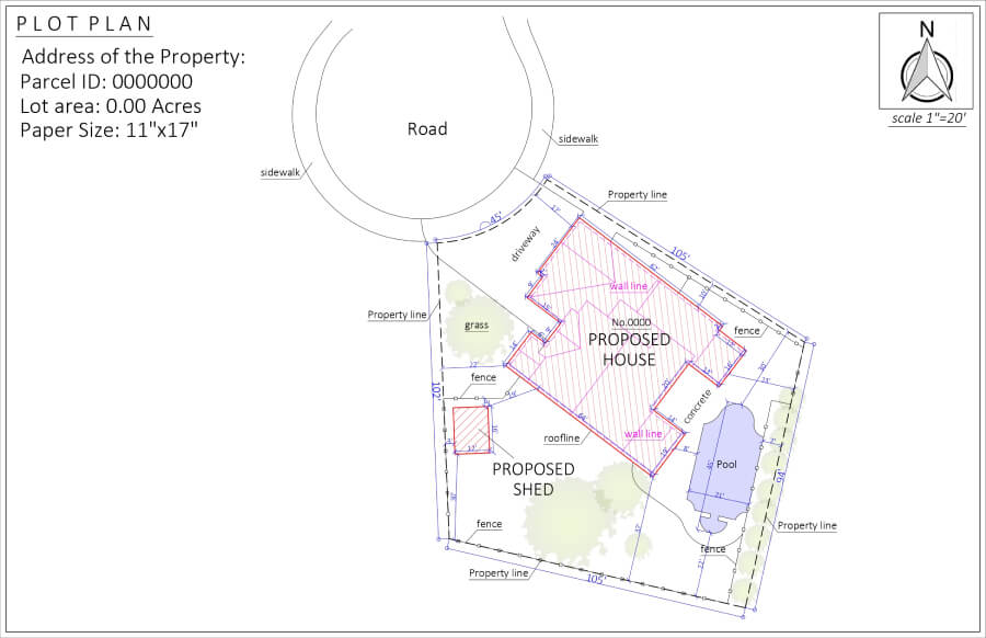
The terms site plan and plot plan are frequently used interchangeably. Their meaning can vary depending on the local authority and the project.
A plot plan typically focuses on one parcel, including property lines, existing buildings, proposed improvements, and setbacks.
A site plan can contain the same information while covering additional details such as landscaping, utilities, drainage, roads, and surrounding development.
The distinction is usually one of scope and detail rather than an entirely different type of drawing.
Our plot plan vs. site plan comparison explains their differences in greater detail.
A floor plan serves another purpose entirely. It shows the internal arrangement of a building, including rooms, walls, doors, and stairs, rather than the position of the building on the property.
No. A site plan is a drawing used to represent a property’s layout and proposed improvements. A land survey is a professional measurement and documentation of land features and, depending on the survey type, legal boundaries.
A non-certified site plan can be created using aerial imagery, geographic information systems (GIS), public records, and supplied measurements.
However, it does not establish legal property boundaries.
If you need precise boundary locations, particularly for a boundary dispute or construction close to a property line, a licensed land surveyor may be necessary.
Our guide to land surveys and plot plans explains when each document is appropriate.

Not every project requires a certified site plan. A non-certified plan can be sufficient for certain residential permits, preliminary planning, and HOA submissions when the reviewing authority accepts it.
Other projects require drawings prepared or certified by licensed professionals, especially when precise boundary verification, engineering design, or specialized calculations are necessary.
The distinction matters because a professional-looking drawing is not automatically an acceptable permit document.
For additional guidance, read about certified site plan requirements.
Start by contacting your local building or planning department to confirm the drawing requirements.
Ask whether non-certified drawings are acceptable, which scale and dimensions are required, and whether supporting engineering or survey documents are necessary.
The City of Portland’s site plan guide illustrates how detailed local requirements can become, covering everything from property setbacks and street access to trees and stormwater facilities.
Next, gather available information about your property, including its address, existing surveys, project dimensions, and proposed construction location.
If a non-certified drawing is acceptable, Get a Site Plan offers remote drafting services using GIS data, satellite imagery, public records, and information supplied by property owners.
You can request a site plan quote based on your property’s location and project requirements.
Yes, provided your local authority accepts homeowner-prepared drawings. The plan must still meet applicable scale, accuracy, and information requirements.
No. Requirements depend on the project and jurisdiction. Exterior improvements and new structures commonly require one, although certain projects qualify for exemptions.
A site plan must provide measurements and details accurate enough for its intended purpose and the reviewing authority’s requirements. Projects requiring legally verified boundaries or elevations may need professional surveying.
Yes. HOAs commonly request property drawings showing the locations and dimensions of proposed improvements. Check your association’s submission requirements first.

Adding a room to your house costs approximately $48,000 on average in 2026, with many homeowners spending between $20,900 and $72,600. Larger additions, bathrooms, and primary suites can cost considerably
Building a new deck costs $8,321 on average in 2026, with most homeowners spending between $4,339 and $12,653. According to Angi’s 2026 deck cost data, those figures come from more

A general contractor manages the construction side of a project from pre-construction through completion. The job usually includes coordinating subcontractors, ordering materials, managing schedules, handling inspections and permits when required
