Room Addition Cost [2026 Data]
Adding a room to your house costs approximately $48,000 on average in 2026, with many homeowners spending between $20,900 and $72,600. Larger additions, bathrooms, and primary suites can cost considerably




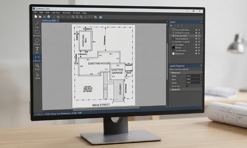

Ten practical site plan examples cover most homeowner needs: existing property, additions, ADUs, decks, pools, fences, detached structures, driveways, grading, and septic systems. Together, they show how proposed work fits within a parcel and what a reviewer may check before approval.
At Get a Site Plan, we prepare scaled, non-certified site plans remotely using GIS data, satellite imagery, public records, existing drawings, and owner-supplied dimensions. Most projects do not require a site visit.
Our plans may be used for permit and HOA applications when the reviewing authority accepts non-certified drawings. They do not establish legal property boundaries or replace work that must be completed by a licensed surveyor, architect, engineer, or other regulated professional.
The authority having jurisdiction (AHJ) decides which documents, certifications, and calculations are required.
| Project Category | Site Plan Examples | Main Review Concern |
| Existing property | Base plan, HOA record plan | Current structures and parcel layout |
| New construction | Addition, ADU, garage, shed | Placement, setbacks, and lot coverage |
| Outdoor work | Deck, pool, fence, driveway | Access, easements, barriers, and drainage |
| Land and utilities | Grading, retaining wall, septic, well | Elevations, water movement, and separation distances |
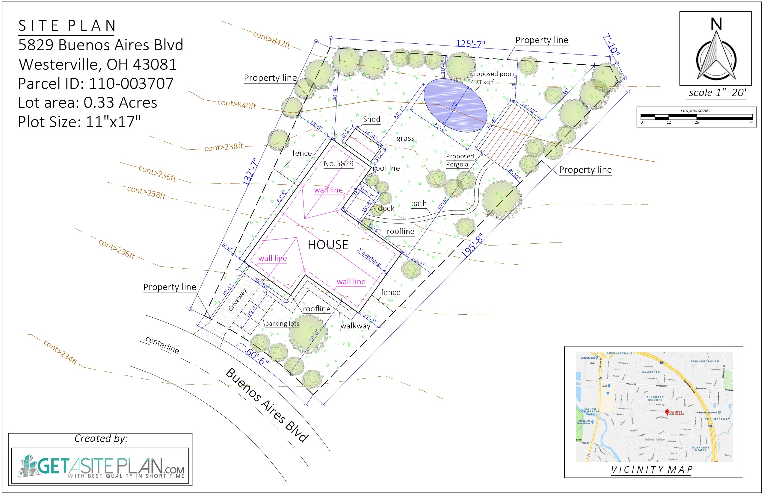
An existing-property plan records the house, accessory buildings, driveway, walkways, fences, pool, major trees, visible utility features, and adjoining street.
Homeowners may use it for planning, contractor discussions, an HOA request, or future revisions. In the plans we prepare, small sheds, older additions, and recent fences are sometimes absent from public data. Measurements, photographs, assessor sketches, and surveys help update the drawing.
An existing-property plan can still contain approximate boundaries. Anyone who needs a legal boundary located on the ground should contact a licensed surveyor. Our guide to ordering a plot plan for a house explains the role of a non-certified property drawing.
A home-addition plan must separate the existing footprint from proposed construction through line weights, labels, or shading.
The plan should show:

Nashville’s addition instructions call for the proposed project, property-line distances, existing structures, and labeled easements. Floor plans, elevations, structural sheets, and energy documents may also be required.
One issue we regularly encounter is a homeowner measuring the new room from the exterior wall while the local rule measures a setback from an eave or another projection. Confirm the jurisdiction’s measurement point before fixing the addition’s location.

An ADU affects placement, access, parking, and utilities. Its site plan must connect the proposed unit to the entire parcel.
Show the ADU’s dimensions, property-line setbacks, distance from the primary residence, and relationship to nearby structures.
Mark the driveway, alley, pedestrian route, required parking, and fire-department access where applicable.
Identify proposed water, sewer or septic, electricity, and gas routes when requested by the AHJ.
San Diego’s updated ADU bulletin demonstrates how setbacks can depend on building height, yard location, project type, and fire-hazard conditions. Based on the ADU permit plans we handle, a dimensioned footprint and clear utility notes often reduce follow-up questions.
Decks, patios, and pergolas may occupy similar areas, although their review details differ.
Centerville, Ohio, shows the variation in its permit thresholds: deck permits depend on area, attachment, or height, while added patio surface can trigger zoning approval. Local figures do not apply nationally.
We often receive detailed framing sketches that lack parcel lines and setback measurements. A deck site plan adds the property context. Structural connections, footings, beams, and joists belong on separate construction drawings when required.
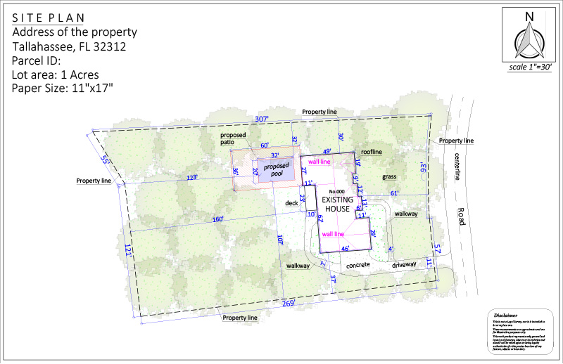
A pool plan may need the shell or waterline, surrounding deck, equipment pad, structures, easements, utilities, drainage, and required safety barrier.
Look for four dimensions in a strong pool example:
Scottsdale’s 2026 pool-plan guidance requires barrier locations and fence heights to appear on the plans. Other cities may add gates, alarms, electrical clearances, lot coverage, or drainage details.
When preparing swimming pool site plans, we often find that pumps, heaters, and utility equipment affect the workable location.
A fence plan follows a route across the parcel. It must remain readable around corners and beside streets or driveways.
Separate existing sections from new work. Add height, material, gates, street frontage, easements, driveway crossings, and regulated sight areas.
Common mistake: A parcel line taken from GIS data is treated as a field-verified boundary. In our fence permit drawings, we can show approximate property information where the reviewing body accepts it. A disputed or uncertain fence line should be located by a surveyor before installation.
Building-permit exemptions do not automatically remove zoning, easement, deed, or HOA restrictions. Ask every relevant reviewer before choosing the fence route.
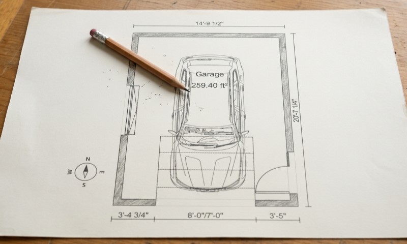
Detached structures need a footprint, use label, dimensions, roof overhang, doors, driveway connection, and setbacks. Height, lot coverage, drainage, and utilities may also affect approval.
The review emphasis changes with the structure:
Clark County’s residential project rules exempt certain small sheds and play structures from building permits. Setbacks and other codes still apply. Homeowners can compare that distinction with the information normally included in our garage site plans.
A driveway plan should connect private work to the street. Show pavement, widths, parking, curb cuts, aprons, sidewalks, rights-of-way, utilities, and drainage.
From our experience with driveway permit plans, three areas deserve early attention:
Expanded pavement may trigger stormwater calculations, drainage details, or a separate right-of-way permit.
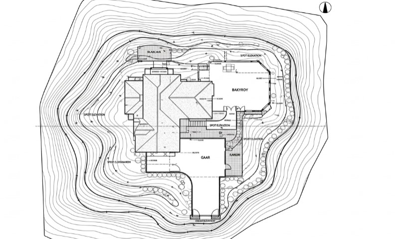
A grading plan explains changing elevations and water movement through contours, spot elevations, slope arrows, swales, inlets, walls, discharge points, and erosion controls.
A retaining-wall example should identify length, location, elevations, boundary distances, slopes, and drainage features. Engineering calculations and structural design remain separate when required.
Flood-prone properties can face added review. Albuquerque includes earthmoving, grading, paving, additions, and drainage work in its floodplain permitting process. A civil or geotechnical engineer may need to prepare or certify parts of the submission. We can incorporate supplied contours and project locations into a retaining-wall site plan, subject to the AHJ’s requirements.
A septic example should show the house, tank, drainfield, replacement area, well, water lines, driveways, waterways, boundaries, and proposed work. Separation distances expose conflicts before excavation.
The EPA’s current septic placement guidance notes that local health departments may establish tank-placement and foundation setbacks. It also recommends locating tanks away from flooding and surface-water ponding.
Homeowners often send us an approved septic drawing or professional measurements. We can transfer supplied locations to a septic permit site plan. Our service excludes soil testing, system design, field verification, and approval.
Good examples make three facts clear: what exists, what will change, and how the project relates to the property. A reviewer should quickly find the proposed work and controlling dimensions.
The exact checklist varies. Bellevue, Washington, says applicants must accurately show property lines, setbacks, streets, rights-of-way, and easements in its residential site plan guidance.
Another jurisdiction may request utilities, fire access, impervious-area calculations, contours, or a professional stamp.
Core items commonly include:
A polished sample can still be the wrong model for a specific application. Choose according to the reviewer’s written checklist and the proposed work.
Before ordering, confirm:
Send us the address, project dimensions, placement measurements, sketches, surveys, and reviewer comments. In our project work, complete source information usually produces a stronger first draft and fewer revisions.
Sometimes. The AHJ must accept its scale, accuracy, and content.
Often, provided every existing and proposed feature is clearly labeled.
Yes. A demolition plan can identify structures being removed and features remaining.
Yes. Local authorities may request tree locations, sizes, species, and proposed replacements.
Yes. It can show the generator, nearby structures, boundaries, utilities, and fuel tank.
Ground-mounted systems often do. Rooftop projects may require roof and electrical drawings instead.
No. Contact 811 before digging so buried utility lines can be marked.
Yes. Send us the reviewer’s comments, and we can update the drawing accordingly.
Plans are normally delivered as PDFs. DWG and JPG files may also be available.
Site plan examples help homeowners recognize the information behind an approval decision. The final drawing must reflect the actual parcel, proposed project, local code, HOA rules, easements, utilities, and environmental constraints.
Start with the closest example, obtain the current checklist, and determine whether the reviewer accepts a non-certified drawing. Once those requirements are clear, we can prepare a scaled plan that presents the property and proposed work in a format suited to the application.

Adding a room to your house costs approximately $48,000 on average in 2026, with many homeowners spending between $20,900 and $72,600. Larger additions, bathrooms, and primary suites can cost considerably
Building a new deck costs $8,321 on average in 2026, with most homeowners spending between $4,339 and $12,653. According to Angi’s 2026 deck cost data, those figures come from more

A general contractor manages the construction side of a project from pre-construction through completion. The job usually includes coordinating subcontractors, ordering materials, managing schedules, handling inspections and permits when required
