
What Is a Site Plan: Definition, Elements and Examples
Planning a home addition, building a garage, or installing a swimming pool usually involves more than deciding where the new structure should go. You also need to show how the






A construction site layout plan typically shows the property boundaries, existing and proposed structures, dimensions, setbacks, driveways, easements, utilities, access points, and other site features needed to understand where construction will occur.
Depending on the project, it may also include grading, drainage, trees, septic systems, wells, flood zones, erosion controls, parking, construction entrances, and staging areas.
At Get a Site Plan, we prepare scaled, non-certified site plans for homeowners, contractors, businesses, and property professionals across the United States.
Our team works remotely using GIS information, satellite imagery, available public property records, existing documents, and measurements or project information supplied by the client. A site visit is generally not required for the plans we provide, including our construction permit site plans.
Our plans can be used for many construction and permit applications when the local authority accepts a non-certified site plan.
They are not legal boundary surveys, and they do not replace a licensed surveyor, engineer, or architect when a jurisdiction requires certified measurements, engineering, or signed and sealed drawings.
That distinction is worth establishing before looking at individual plan elements because the phrase construction site layout plan can describe anything from a relatively simple residential permit drawing to a highly detailed site-development or construction-logistics plan.
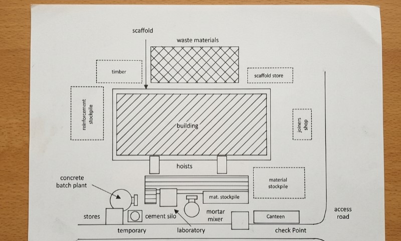
Most construction site plans contain a core group of elements, with additional information added when the property or permit requires it.
| Plan Element | What It Helps Establish |
| Property boundaries | Shape and dimensions of the parcel |
| Existing structures | Current development on the property |
| Proposed structures | Location and size of planned construction |
| Setbacks | Distances from structures to property lines |
| Easements | Areas affected by recorded rights or restrictions |
| Driveways and access | Vehicle and pedestrian access |
| Utilities | Relevant water, sewer, power, gas, or drainage infrastructure |
| North arrow and scale | Orientation and measurable distances |
| Topography and drainage | Ground levels and water movement |
| Trees and site features | Existing conditions that may affect construction |
| Lot coverage | How much of the parcel is occupied by structures |
| Construction controls | Disturbance limits, access, staging, or erosion measures when required |
A construction site layout plan is a scaled overhead drawing that explains how proposed construction relates to the property around it.
The drawing normally combines existing conditions with proposed work. A reviewer can see where the lot begins and ends, where buildings already stand, where the new structure will go, and whether other features such as easements, utilities, drainage routes, trees, or access points affect the project.
Local terminology varies. Permit departments may refer to a similar document as a:
A construction site layout plan usually shows the parcel outline along with boundary dimensions. Depending on local requirements, the sheet may also identify the address, parcel number, subdivision, lot number, property owner, and preparer.
A north arrow and scale are normally included as well.
Property lines deserve particular attention because many permit decisions depend on distances measured from them. Setbacks, easements, building separation, accessory structure placement, and lot coverage can all be affected by boundary location.
For the non-certified plans we prepare, approximate boundaries can be developed from available GIS, assessor, mapping, and client information. Such sources are useful for drafting, but they should not be represented as surveyed legal boundaries when no field survey has taken place.
Local requirements vary dramatically on that point. Some jurisdictions allow public property information to serve as a reference for certain applications, while others impose stricter requirements.
For example, San Mateo County’s permit requirements state that the plot plan for new construction or major additions must be a topographic survey signed and stamped by a licensed surveyor.
A reviewer should be able to tell immediately what already exists and what the project will change.
Existing features might include the primary residence, commercial building, detached garage, shed, deck, patio, pool, driveway, retaining wall, fence, or other improvements relevant to the application.
Proposed construction should then be identified separately.
For a home addition, for example, the drawing might show the existing building footprint with the proposed extension attached to one side.
A detached ADU would instead appear as a new standalone footprint positioned relative to the house and property boundaries.
Dimensions are normally added so the reviewer can see the size of the proposed work.
Municipal requirements can become quite specific. The Bellevue residential site-plan checklist, for example, asks applicants to show the location, size, and use of structures along with their distances to property lines.
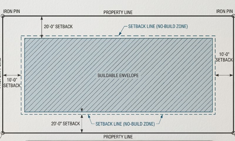
A setback shows the distance between a structure and a property line or another regulated feature. Front, rear, and side-yard setbacks are common, although additional setback rules may apply around roads, streams, wetlands, easements, shorelines, or protected areas.
A plan may also show distances between structures where building separation is relevant.
One point is easy to overlook: drawing a setback and establishing the required setback are different jobs.
Zoning rules can vary according to district, building type, height, lot width, corner-lot conditions, overlays, and the type of proposed structure. A garage, ADU, shed, pool, and primary residence may all be regulated differently.
The required distance should therefore come from the applicable local zoning rules or permitting department rather than being assumed from another project.
Easements can affect where construction is possible even when ordinary zoning setbacks are satisfied.
Common examples include utility, drainage, access, sewer, conservation, and shared-driveway easements.
Where known and relevant, the site layout should show their location and width. Roads, alleys, public rights-of-way, and similar features may also need to be identified.
Recorded easements may not always be obvious from aerial imagery or assessor maps. When a project sits close to an easement or suspected easement, deeds, plats, title information, surveys, or other recorded documents can become important.
A construction layout often needs to explain how vehicles reach the property and how the proposed work relates to existing access.
Residential plans may show a driveway, driveway apron, parking space, garage approach, sidewalk, or street connection.
Larger projects can involve additional access information such as loading areas, turning areas, fire access, delivery routes, or internal circulation.
Permanent access should be distinguished from temporary construction access.
A driveway that will remain after the project is finished belongs to the permanent site layout. A route created for dump trucks, cranes, or construction deliveries serves a different purpose and may only exist during construction.
Utilities frequently appear where they affect proposed construction or form part of the permit review.
A site plan may identify:
Properties with private water or wastewater systems may also need wells, septic tanks, drain fields, or leach fields shown.
Showing an existing or proposed utility location does not automatically mean the site plan provides engineering for that system. Septic design, utility calculations, stormwater infrastructure, and similar technical work may require separate approval or a qualified professional.
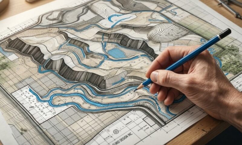
Ground conditions become important when construction changes elevation or alters the way water moves across the property.
A detailed plan can include:
A simple project on relatively flat land may not require that degree of detail. Excavation, steep slopes, substantial grading, retaining structures, or new development can lead to more extensive civil or grading documentation.
Likewise, mapped contour information used for a non-certified drawing should not be presented as field-surveyed elevation data when certified elevations are required.
Depending on the location, reviewers may ask for trees, wetlands, streams, steep slopes, flood areas, shoreline features, or other environmentally sensitive areas.
Floodplain projects can bring another layer of documentation. FEMA’s floodplain permit materials include site-plan considerations such as mapped floodplain and floodway boundaries, development location, drainage, fill, and other information needed to evaluate work in flood-prone areas.
When a project enters a regulated floodplain, wetland, critical area, or unstable slope, a normal site plan may be only one part of the required permit package.
Many zoning departments want to know how much of the property is occupied by buildings or hard surfaces.
Lot coverage usually compares building footprint area with total lot area. Impervious coverage can include roofs, driveways, patios, parking areas, and other surfaces that limit water infiltration.
Requirements and calculation methods differ between jurisdictions, so percentages should be based on the applicable local definition rather than a generic formula pulled from another city.
Construction affects more than the final building footprint.
Excavation, grading, trenching, equipment movement, stockpiling, and material handling can disturb soil elsewhere on the lot. Some site plans therefore need to show limits of disturbance and erosion-control measures.
Federal stormwater rules can also become relevant.
Under current EPA construction stormwater guidance, permit coverage is generally required for qualifying stormwater discharges from construction disturbing one acre or more, as well as smaller sites that are part of a larger common plan of development ultimately disturbing at least one acre.
Clearing, grading, and excavation are among the activities covered.
Local and state rules can apply below the federal threshold, so one acre should never be treated as a universal exemption.
Sometimes.
The answer depends partly on whether the permit department is requesting a traditional site plan or a broader construction-logistics layout.
| Permit Site Plan | Construction Logistics Plan |
| Property boundaries | Material staging |
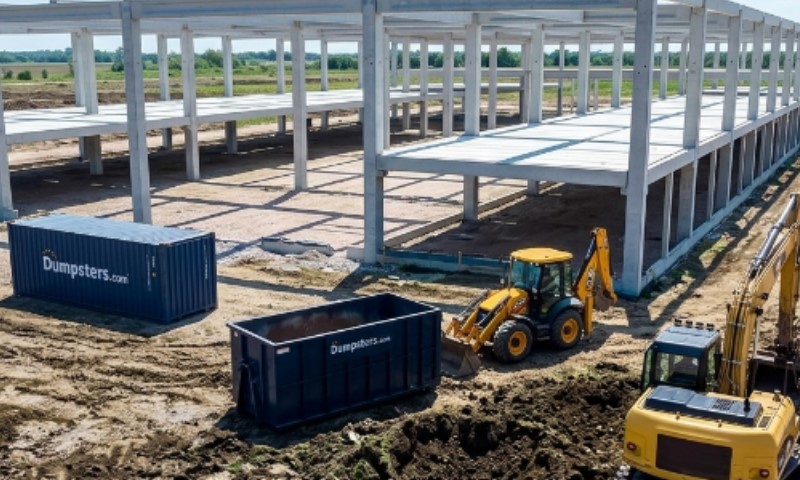
| Building footprints | Dumpster locations |
| Setbacks | Temporary fencing |
| Easements | Crane or equipment areas |
| Driveways | Delivery routes |
| Utilities | Temporary site access |
| Drainage | Material storage |
| Lot coverage | Worker and vehicle circulation |
Some jurisdictions combine elements from both. Johns Creek’s site-plan requirements, for example, can require construction entrances, dumpster placement, lay-down or staging areas, disturbance limits, and erosion controls to appear on a full site plan.
Safety planning can also influence logistics. OSHA’s steel erection rules address adequate site access for cranes, trucks, equipment, and materials, along with pedestrian and vehicle controls and sufficient working and material-storage areas.
A small residential addition may never need a formal logistics plan. A commercial site with cranes, deliveries, temporary storage, and multiple trades can require much more coordination.
Site plans and surveys can contain similar-looking information, but they are not interchangeable.
| Document | Primary Purpose |
| Non-certified site plan | Show existing and proposed property development for planning, HOA, or permit use where accepted |
| Boundary/topographic survey | Establish surveyed boundaries, monuments, elevations, and other field-measured information |
| Civil or engineering plan | Design technical site infrastructure, grading, drainage, or other engineered systems |
| Construction logistics plan | Organize temporary access, storage, deliveries, equipment, and job-site operations |
For projects where a non-certified plan is accepted, our team at Get a Site Plan can prepare a construction permit drawing using available property data and client information.
It can include approximate property lines, building footprints, dimensions, setbacks, easements, existing structures, driveways, visible utilities, trees, parking, and other requested site information.
The service is intentionally remote and does not involve field surveying.
When a permit department asks for a stamped survey, certified elevations, structural calculations, civil engineering, or another licensed service, the correct response is to involve the professional the jurisdiction requires rather than trying to make a non-certified plan serve a different purpose.
Ask the local permitting department what type of site plan it accepts and whether any project-specific checklist is available.
A few questions can determine the entire scope:
| Question | Why It Matters |
| Is a non-certified plan accepted? | Determines whether remote drafting may be sufficient |
| Is a survey required? | Establishes whether field-verified boundaries are necessary |
| Does the plan need a professional stamp? | May require a licensed professional |
| What setbacks apply? | Determines allowable structure location |
| Are grading or contours required? | May increase plan complexity |
| Must easements be documented? | Can affect buildable area |
| Are lot-coverage calculations required? | Common zoning-review item |
| Are drainage controls required? | May require additional site information |
| Is the property in a critical area? | Can trigger specialized documentation |
| Are staging areas required? | Relevant to construction-logistics review |
The contrast between jurisdictions shows why that first check matters. One city or county may accept a site plan created from available property information for a particular project, while another may require a survey prepared by a licensed professional.
No. Some minor repairs, interior alterations, or other limited work may not require one. The local permit office decides.
Often, yes. Many jurisdictions accept or require PDF plans through an online permitting portal, but file and sheet requirements vary.
Yes. If plan review identifies corrections, you can typically revise the affected sheets and resubmit them for another review.
Usually not. A permit site plan should focus on the work covered by the current application unless the reviewing authority specifically requests future improvements.
It can be. Some jurisdictions require a demolition site plan showing what will be removed and which buildings or improvements will remain.
Occasionally, for certain minor permits. Most construction applications still require a properly prepared site plan that meets the local submission standards.
Potential reviewers can include building, planning, zoning, transportation, floodplain, environmental, and public works departments, depending on the project.
No. Some minor repairs, interior alterations, or other limited work may not require one. The local permit office decides.
Often, yes. Many jurisdictions accept or require PDF plans through an online permitting portal, but file and sheet requirements vary.
Yes. If plan review identifies corrections, you can typically revise the affected sheets and resubmit them for another review.
Usually not. A permit site plan should focus on the work covered by the current application unless the reviewing authority specifically requests future improvements.
It can be. Some jurisdictions require a demolition site plan showing what will be removed and which buildings or improvements will remain.
Occasionally, for certain minor permits. Most construction applications still require a properly prepared site plan that meets the local submission standards.
Potential reviewers can include building, planning, zoning, transportation, floodplain, environmental, and public works departments, depending on the project.
A good construction site layout plan is the drawing that gives the reviewer the information needed for the particular property and project.
At a glance, the reviewer should be able to identify the lot, understand what is already there, locate the proposed work, check important dimensions, see how the site is accessed, and recognize easements, utilities, drainage conditions, or other constraints that affect construction.
For many residential and commercial applications, a non-certified plan can provide that information efficiently. Get a Site Plan prepares such drawings remotely from available property records, mapping data, GIS and satellite information, and details supplied by the customer.
For projects requiring surveyed boundaries, certified elevations, engineering, or professional stamps, the scope changes and the appropriate licensed professional should become part of the process. Knowing the difference before drafting begins makes the site plan more useful, reduces avoidable permit revisions, and gives everyone involved a clearer picture of how the proposed construction fits onto the property.

Planning a home addition, building a garage, or installing a swimming pool usually involves more than deciding where the new structure should go. You also need to show how the
Adding a room to your house costs approximately $48,000 on average in 2026, with many homeowners spending between $20,900 and $72,600. Larger additions, bathrooms, and primary suites can cost considerably
Building a new deck costs $8,321 on average in 2026, with most homeowners spending between $4,339 and $12,653. According to Angi’s 2026 deck cost data, those figures come from more
